Page 123 - Beaumont Basin Watermaster
P. 123

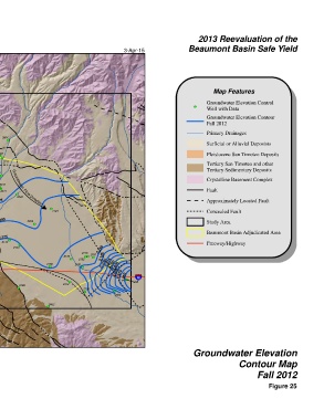
2013 Reevaluation of the
 Beaumont Basin Watermaster                     3-Apr-15                Beaumont Basin Safe Yield


 § ¨ ¦
 10
                                                                                  Map Features
 1951
 ! (
                                                                               Groundwater Elevation Control
                                                                          ! (
                                                                               Well with Data
 ! ( 2259
                                                                               Groundwater Elevation Contour
 2260
 ! (  2107                                                                     Fall 2012
 ! (
 2,075
 2143  ! (
 2,100
 ! (  ! (  2425                                                                Primary Drainages
 2,125
 2143
 1,875
 2901  3004
 ! (  2888  ! (  ! (
 1725  ! (                                                                     Surficial or Alluvial Deposists
 1724  2139 2135  2167  ! ( 2904
 ! (  ! (1793  2140  ! (  ! (  2136 ! (  ! ( !( 2169  2174  2831 ! (
 1,875  2126  2173  2497 ! (  ! ( ! (
 1863  1,900  ! ( !(  ! (  ! ( 2546  2707                                      Pleistocene San Timoteo Deposits
 ! (
 ! (  ! ( 2124  ! (  2178 ! (  2163  2711
 ! (
 1893  1,925  2153  ! (  2,150  ! (  2,175  2637 ! (                           Tertiary San Timoteo and other
 1,950  1,975  2,000  2141  ! ( !( 2169 ! ( 2191  2244 ! (                     Tertiary Sedimentary Deposits
 2,025
 2,050
 2,075 2,100  2179 2160 ! (  2168  2168 ! ( Groundwater Flow Direction  ! ( 2243  Groundwater Flow Direction  Crystalline Basement Complex
 ! (
                                                                               Fault
  2241
 ! (
 ! (
 2,150                                                                         Approximately Located Fault
 2124  2,125  2178  2,175  ! (  2,225  ! ( 2220
 2,175  2184 ! (    ! ( 2191                                                   Concealed Fault
 2,200  Noble Creek  2196  2,200  2204 ! (                                     Study Area
 ! (
 San T imoteo Creek
 U V  2221  ! ( 2,225 2,250  ! (  2256  Marshall Creek                         Beaumont Basin Adjudicated Area
 60
 2,275  2,300  2,325  2,175  ! (  2133 ! (  2,150                              Freeway/Highway
  2172
 2,350
 2366
 ! (
                                2146
                                    ! (
 ! (  2398               2170 ! (  2152 ! ( ! (  2161  2,125
 2460  ! (                                2,075
                   2188      2141      2,100  2,050
                    ! (         ! (         2,025
                                            2,000  1,975  1,950  ! ( § ¨ ¦
 2401
 ! (
                                                     10
 2465 ! (  2474  2496    2414 ! (                  1938
 ! (    ! (                      2155
 ! (                             ! (        ! (
 2450                                       2064
                   2462
                   ! (
 Ü
 0  0.5  1  2                                                             Groundwater Elevation
 Miles
 NAD 83 State Plane Zone 6                                                                 Contour Map
                                                                                                  Fall 2012
                                                                                                       Figure 25
   118   119   120   121   122   123   124   125   126   127   128