Page 113 - Beaumont Basin Watermaster
P. 113

2013 Reevaluation of the
 Beaumont Basin Watermaster                     3-Apr-15                Beaumont Basin Safe Yield


 § ¨ ¦
 10


                                                                                  Map Features

                                                                          56   Percent Coarse Sediment
                                                                               from Borehole Log
                                                                        Percent Coarse Sediment
 28
 74                                                                            20 - 30
 69                                                                            30 - 40

 25  48  98                                                                    40 - 50
 28  58  56
 76                                                                            50 - 60
 87
 77  65                                                                        60 - 70
 89  64
                                                                               70 - 80
 63  48
 72  50
 51                                                                            80 - 90
 70                                                                            90 - 100
                 100
                                                                               Extent of Analysis
            86
                                                                               Surficial or Alluvial Deposists

 U V  63  85                                                                   Pleistocene San Timoteo Deposits
 60
 43                                                                            Tertiary San Timoteo and other
                       100     62 65                                           Tertiary Sedimentary Deposits
                          79
                                                                               Crystalline Basement Complex
                             86
                           46                                                  Study Area
                          71                      § ¨ ¦
                                                   10
                                                                               Beaumont Basin Adjudicated Area

                                                                               Freeway/Highway

 Ü                                                                     Note: All borehole logs were logged through


                                                                               at least 50% of the layer.


 0  0.5  1  2
 Miles
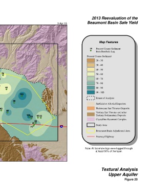
 NAD 83 State Plane Zone 6                                                          Textural Analysis

                                                                                         Upper Aquifer
                                                                                                       Figure 20
   108   109   110   111   112   113   114   115   116   117   118