
Page 130 - Beaumont Basin Watermaster
P. 130
San Bernardino Mountains
2013 Reevaluation of the
Beaumont Basin Watermaster 3-Apr-15 Beaumont Basin Safe Yield
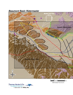
Model Cell Size
164 ft
10 164 ft
393 Columns Map Features
Time-Varying Specified Head
Boundary Well
Gorgonio Creek
Inactive Model Zone 210 Rows Boundary Recharge Cell
Little San General Head Boundary
Modeled Faults
Surficial or Alluvial Deposists
Pleistocene San Timoteo Deposits
Tertiary San Timoteo and other
Tertiary Sedimentary Deposits
Noble Creek Crystalline Basement Complex
Model Domain
Beaumont Basin Adjudicated Area
Creek
60
Smith Creek Freeway/Highway
Inactive Model Zone
10
0 0.5 1 2
Miles
NAD 83 State Plane Zone 6 Model Boundary Conditions
Figure 29