
Page 377 - Beaumont Basin Watermaster
P. 377
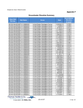
Beaumont Basin Watermaster
                                                                                                  Appendix F

                                         Groundwater Elevation Summary

                                                                                               Groundwater
             State Well                                                                         Elevation
              Number         Well Name                     Owner                     Date
                                                                                                 (ft amsl) 1
            2S/1W-35J02 335714116565003         United States Geological Survey   12/20/2011      2,190.0
            2S/1W-35J02 335714116565003         United States Geological Survey    1/13/2012      2,190.5
            2S/1W-35J02 335714116565003         United States Geological Survey    2/7/2012       2,191.3
            2S/1W-35J02 335714116565003         United States Geological Survey    3/13/2012      2,192.0
            2S/1W-35J02 335714116565003         United States Geological Survey    4/17/2012      2,192.9
            2S/1W-35J02 335714116565003         United States Geological Survey    5/21/2012      2,191.9
            2S/1W-35J02 335714116565003         United States Geological Survey    5/24/2012      2,191.8
            2S/1W-35J02 335714116565003         United States Geological Survey    6/13/2012      2,192.3
            2S/1W-35J02 335714116565003         United States Geological Survey    6/19/2012      2,192.0
            2S/1W-35J02 335714116565003         United States Geological Survey    7/11/2012      2,192.5
            2S/1W-35J02 335714116565003         United States Geological Survey    8/17/2012      2,191.3
            2S/1W-35J02 335714116565003         United States Geological Survey    8/31/2012      2,190.4
            2S/1W-35J02 335714116565003         United States Geological Survey    9/28/2012      2,191.5
            2S/1W-35J02 335714116565003         United States Geological Survey   10/26/2012      2,191.9
            2S/1W-35J02 335714116565003         United States Geological Survey    11/9/2012      2,191.1
            2S/1W-35J02 335714116565003         United States Geological Survey    12/8/2012      2,191.3
            2S/1W-35J02 335714116565003         United States Geological Survey   12/15/2012      2,191.4
            2S/1W-35J02 335714116565003         United States Geological Survey   12/19/2012      2,191.7
            2S/1W-35J02 335714116565003         United States Geological Survey    1/1/2013       2,192.1
            2S/1W-35J03 335714116565001         United States Geological Survey    4/22/2004      2,221.6
            2S/1W-35J03 335714116565001         United States Geological Survey    6/28/2004      2,220.2
            2S/1W-35J03 335714116565001         United States Geological Survey    8/12/2004      2,218.8
            2S/1W-35J03 335714116565001         United States Geological Survey    9/16/2004      2,217.6
            2S/1W-35J03 335714116565001         United States Geological Survey   10/25/2004      2,216.4
            2S/1W-35J03 335714116565001         United States Geological Survey    12/3/2004      2,215.0
            2S/1W-35J03 335714116565001         United States Geological Survey    1/13/2005      2,216.0
            2S/1W-35J03 335714116565001         United States Geological Survey    3/10/2005      2,215.9
            2S/1W-35J03 335714116565001         United States Geological Survey    4/29/2005      2,214.4
            2S/1W-35J03 335714116565001         United States Geological Survey    7/6/2005       2,213.1
            2S/1W-35J03 335714116565001         United States Geological Survey    9/8/2005       2,211.0
            2S/1W-35J03 335714116565001         United States Geological Survey   11/15/2005      2,210.1
            2S/1W-35J03 335714116565001         United States Geological Survey   11/29/2005      2,209.0
            2S/1W-35J03 335714116565001         United States Geological Survey    1/18/2006      2,214.6
            2S/1W-35J03 335714116565001         United States Geological Survey    3/3/2006       2,208.6
            2S/1W-35J03 335714116565001         United States Geological Survey    5/3/2006       2,209.6
            2S/1W-35J03 335714116565001         United States Geological Survey    5/16/2006      2,208.3
            2S/1W-35J03 335714116565001         United States Geological Survey    9/15/2006      2,202.0
            2S/1W-35J03 335714116565001         United States Geological Survey    11/6/2006      2,203.7
            2S/1W-35J03 335714116565001         United States Geological Survey    1/11/2007      2,201.7
            2S/1W-35J03 335714116565001         United States Geological Survey    2/12/2007      2,201.4
            2S/1W-35J03 335714116565001         United States Geological Survey    2/22/2007      2,200.5
            2S/1W-35J03 335714116565001         United States Geological Survey    5/2/2007       2,200.3
            2S/1W-35J03 335714116565001         United States Geological Survey    5/16/2007      2,198.9


                                                       153 of 157                                      3-Apr-15